Sanborn maps, sometimes called fire maps, are detailed maps of U.S. cities and towns in the 19th and 20th centuries. Originally published by The Sanborn Map Company (Sanborn), the maps were created to allow fire insurance companies to assess their total liability in urbanized areas of the United States. Since they contain detailed information about properties and individual buildings in approximately 12,000 U.S. cities and towns, Sanborn maps are valuable for documenting changes in the built environment of American cities over many decades.
Sanborn held a monopoly over fire insurance maps for the majority of the 20th century, but the business declined as US insurance companies stopped using maps for underwriting in the 1960s. The last Sanborn fire maps were published on microfilm in 1977, but old Sanborn maps remain useful for historical research into urban geography. The license for the maps was acquired by land data company Environmental Data Resources (EDR), and EDR was acquired in 2019 by real estate services company LightBox.
Sanborn Keys & Colors – from the Library of Congress
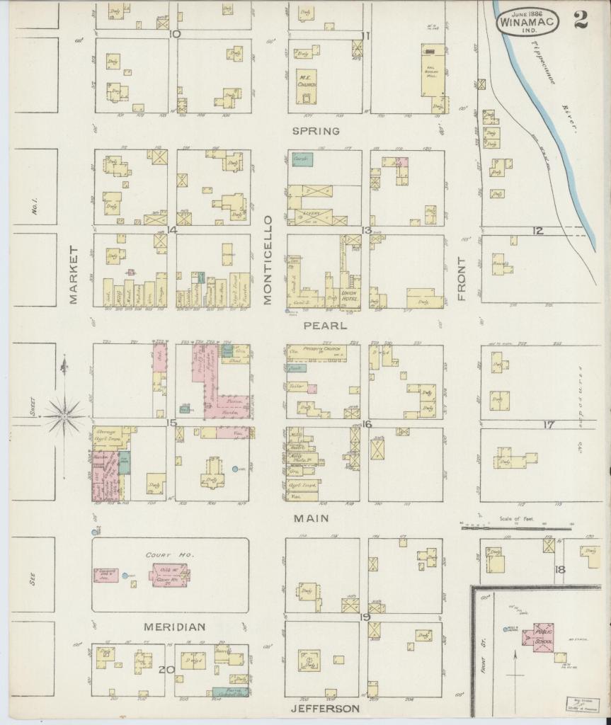
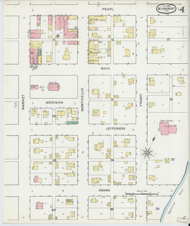
Winamac 1893
Fire insurance maps are distinctive because of the sophisticated set of symbols that allows complex information to be conveyed clearly. In working with insurance maps, it is important to remember that they were made for a very specific use, and that although they are now valuable for a variety of purposes, the insurance industry dictated the selection of information to be mapped and the way that information was portrayed. Knowledge of the keys and colors is essential to proper interpretation of the information found in fire insurance maps.
Unique information includes the location of the homes of prominent individuals, brothels, and more ephemeral buildings including outhouses and stables.
Insurance underwriting – from Wikipedia
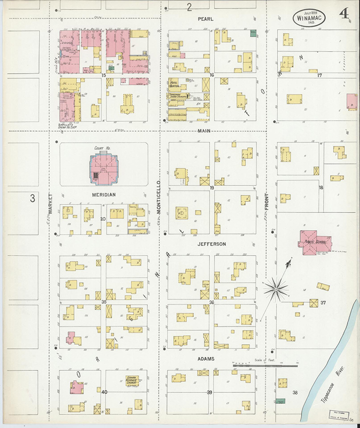
Winamac 1899
At the outset of the fire insurance industry, underwriters visited every property that was under consideration for coverage. As insurance companies increased their service areas, it was no longer practical to send people to every insurable property to assess the risk. The Sanborn maps allowed them to underwrite properties from the office, pooling the cost with other insurance companies that also subscribed to the maps. It was said that at one time, insurance companies and their agents “relied upon them with almost blind faith”.
The maps were utilized by insurance companies to determine the potential risk of a particular building, taking into account all of the information included on the map: building material, proximity to other buildings and fire departments, the location of gas lines, etc. The decision as to how much, if any, insurance would be offered to a customer was often determined solely through the use of a Sanborn map. The maps also allowed insurance companies to visualize their exposure in their coverage areas; when an agent sold a policy, he could color in the corresponding building on the map.
History – Edited Version from WIkipedia
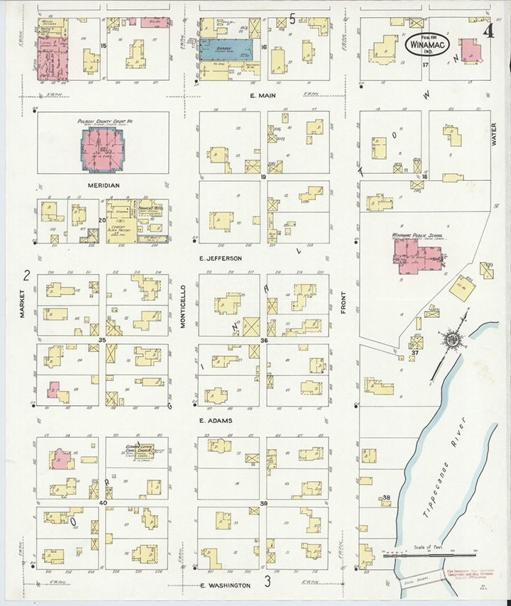
Winamac 1911
In the late 18th century, insurance companies in London began to create detailed maps to give underwriters the information they needed to assess fire risk. The practice was adopted by American insurance companies in the mid-19th century.
Daniel Alfred Sanborn, a civil engineer and surveyor, began working on fire insurance maps in 1866. That year, he was contracted by the Aetna Insurance Company to prepare maps of areas in Tennessee.
About the same time, he developed similar maps of Boston, published as Insurance Map of Boston, Volume 1, 1867. Seeing a lucrative market for this type of map, he established the D. A. Sanborn National Insurance Diagram Bureau in New York City to publish the Boston atlas and develop and sell maps of additional areas.
Within several decades, the company became the largest and most successful American map company. This growth came about through savvy management and the buyout of competing firms.
In 1889 Sanborn acquired Perris and Browne, an older firm, and can by virtue of this expansion date its origins to 1852.
In 1916, Sanborn purchased its last major competitor, the E. Hexamer & Sons of Philadelphia, and became a monopoly. Company headquarters moved to Pelham, New York, but there were also regional offices in San Francisco, Chicago, and Atlanta. The Sanborn Company sent out legions of surveyors to map building footprints in all major urbanized areas, along with building details related to fire risk.
At its peak in the 1920s, the company employed about 700 people, including about 300 field surveyors and 400 cartographers, printers, managers, salesmen, and support staff. Areas under intensive development were surveyed every six months.
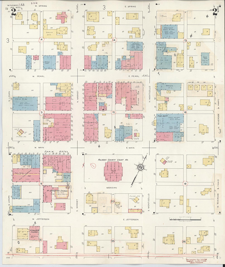
Winamac 1933
By 1936, Sanborn had reduced its publishing output from 60 to 20 volumes per year, a pace that would take over 50 years to update the entire map collection.
In the 1950s, insurance companies began to use an alternative form of underwriting known as line carding. Line carding had been used for decades to underwrite properties that were not covered by fire maps. Each insured property was listed on a single card, and no map was kept. Corporate mergers also reduced the need for Sanborn Maps, since the consolidated company only needed to buy one set of maps. As insurance companies increased in size, they could withstand larger disasters and no longer needed to use insurance maps to reduce their concentration of risk. Companies also cited “modern building construction, better building fire codes, and improved fire protection methods for the decline in importance of fire insurance maps.”
With the decline of its insurance business, Sanborn could no longer afford to maintain its army of surveyors. However, the company continued to sell its maps and perform some updates. Government sales began to play a larger role, especially the Census Bureau and municipal planning agencies. Sanborn printed its last catalog in 1950, created its last new map in 1961, and issued its last update in 1977.
In 1996, the license for the maps was acquired by land data company Environmental Data Resources (EDR). In 2019, EDR was acquired by real estate services company LightBox.
Winamac 1943
Library of Congress Sanborn Maps Search Engine
https://www.loc.gov/collections/sanborn-maps/about-this-collection
At the Library of Congress, this writer was able to locate maps for Winamac, Francesville, and Medaryville. (I looked for but did not find maps for Monterey, Pulaski, Star City, or Thornhope, nee Rosedale and Oak.
Rather than recreate that page, we invite you to visit, bookmark, and search away!